Application Description
Easily plan your route with Just Draw It! - Route Planner. Simply swipe your finger across the map to draw your path and see the total distance right away. Ideal for running, walking, cycling, and other outdoor adventures, this app removes the uncertainty of where to head next. Save your preferred routes, import and export GPX files, and view elevation profiles for your path. With tools like snap-to-roads and places search, route planning becomes effortless. Stop worrying about getting lost—explore confidently with Just Draw It! - Route Planner.
Key Features of Just Draw It! - Route Planner:
* Draw Your Route with a Swipe: Plan your path smoothly by drawing directly on the map.
* Import & Export GPX Files: Modify existing routes or share them with others.
* Measure Distance Between Points: Get precise distance data for your planned route.
* Save Favorite Routes: Keep your most-used routes handy for future outings.
* Snap to Roads: Align your routes accurately with streets and pathways.
* View Route Elevation Profile: Check elevation changes along your chosen path.
Helpful Tips for Users:
* Plan and measure your route before heading out—use Just Draw It! - Route Planner for accuracy.
* Import GPX files and customize them to suit your preferences and save time.
* Share routes with friends to enjoy new trails and paths together.
* Start anywhere easily by searching for locations with the places search tool.
* Review the elevation profile to prepare for hills and slopes on your route.
Final Thoughts:
Just Draw It! - Route Planner is the ideal companion for your outdoor activities, whether walking, running, cycling, or boating. Thanks to its intuitive design and accurate measurements, creating your ideal route is simpler than ever. Download the app today and explore your surroundings with confidence!
Screenshot


Reviews
Post Comments
Latest Articles

Monument Valley 3 Documentary Reveals The Making Of
Ustwo Games has released a short documentary, "Building the Impossible: The Making of Monument Valley 3." The game arrived on PC and consoles last week, and this new video offers a deeper insight into the creative process behind the latest puzzle-adv
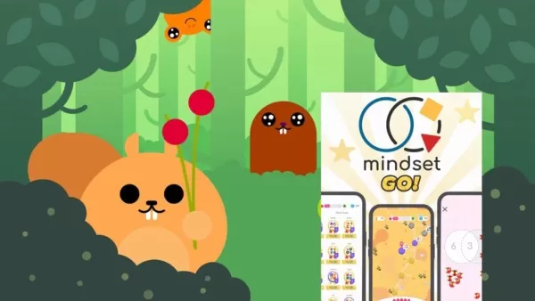
Mindset GO! Launches New Venn Diagram Puzzle Game
Mindset GO! elevates the smart-casual puzzle genre to a new level. Now available on Android, iOS, and the web, it merges keen observation with logical reasoning through a unique gameplay mechanic. Developed by Magicave, the game features a system rem
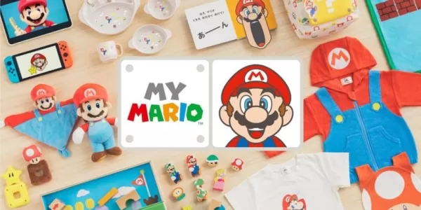
Hello, Mario! is a new made-for-kids app as part of Nintendo\'s big Mario push
Hello, Mario! is Nintendo’s latest venture into the Mario lifestyle experience.
It’s part of the new My Mario product line.
Gently poke, prod, or pinch Mario’s face—just like in the N64 version—to trigger a range of playful reactions. Those who grew

Splash Update Makes Waves in The Sims Freeplay
The Sims Freeplay introduces its latest lineup of in-game eventsHost a Pride Party, compete in a BBQ showdown, and rescue the community poolWatch for the arrival of the new neighborhood, Breezy FieldsWith summer in full swing (at least for those enjo
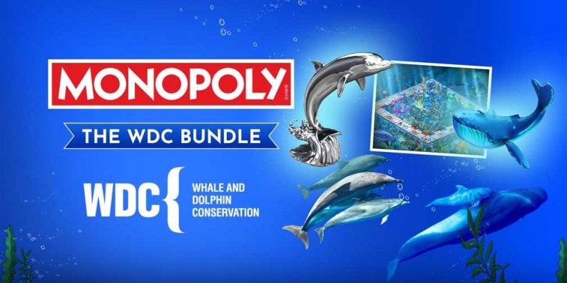
Monopoly Joins Forces to Save Whales in New Partnership
A portion of the revenue will support marine life preservation initiativesSecure the exclusive bundle featuring a themed board and unique tokenWDC works tirelessly to safeguard whales and dolphins from hunting pressures and pollutionMarmalade Game St
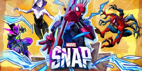
Marvel Snap releases the Arachnid Anarchy season ahead of the Golden Gauntlet World Championship
Arachnid Anarchy is now live featuring Spider-PunkMore Spider-Verse characters and maps also part of the updateThe Golden Gauntlet World Championship takes place Nov 8thMarvel Snap enters its loudest era yet this November. The new Arachnid Anarchy se
Apps like Just Draw It! - Route planner

ESMO Events
Lifestyle丨22.30M


Cheddar's Scratch Kitchen
Lifestyle丨203.60M


Aiuta – AI Stylist
Lifestyle丨24.78M


sonnenCharger App
Lifestyle丨60.80M

Latest Apps


Wall Paint Calculator
Lifestyle丨10.00M

Logi Circle
Lifestyle丨49.50M

تكبير المؤخرة و الارداف
Lifestyle丨13.00M


Sound monitor FFTWave
Tools丨4.30M
Trending Apps
MORE +


Top News
MORE +
01
02-03
Roblox: Anime Adventures Codes (January 2025)
Anime Adventures Codes: A Comprehensive Guide to Free Gems and Rewards
This guide provides an up-to-date list of working and expired Anime Adventures codes in Roblox. Redeeming these codes grants valuable in-game gems and other rewards, giving you a head start in your adventure.
Updated January 5,
02
05-26
Enhance Your MU Immortal Experience with BlueStacks Features
MU Immortal captures the essence of classic MMORPG gameplay that fans adore—leveling up, enhancing stats, and crafting your ideal character. Designed primarily for mobile, the game truly shines when played on a PC using BlueStacks, thanks to an array of tools that streamline and enhance your gaming
03
05-16
"Clair Obscur: Expedition 33 Hits 1 Million Sales in 3 Days"
Clair Obscur: Expedition 33 has taken the gaming world by storm, achieving a phenomenal opening weekend by selling over 1 million copies just three days after its launch. This remarkable feat cements its status as the highest player-rated game of early 2025. Dive deeper into the journey of this grou
04
04-21
Roblox Anime Genesis: January 2025 Codes
Dive into the thrilling world of Anime Genesis, a dynamic tower defense game on Roblox where you assemble a squad of your favorite anime characters to fend off menacing monsters. Whether you're tackling levels solo or teaming up with friends, you'll earn gems that you can use to summon new heroes, e
05
01-20
New DLC and Preorder for FANTASIAN
FANTASIAN Neo Dimension: DLC and Pre-order Information
While anticipation for extra content is high, a FANTASIAN Neo Dimension DLC or story expansion is unlikely. Mistwalker head Hironobu Sakaguchi has stated his preference against sequels, aiming for complete, self-contained gaming experiences.
Topics
More +