Application Description
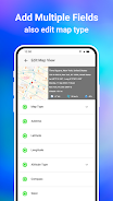
The GPS Map Camera App seamlessly integrates camera functionality with GPS location tracking. Features like geotagging, GPS scanning, and GPS mapping enable users to create visually rich travel logs. The app boasts a robust mapping system, allowing users to view their photos geographically on a GPS map. Beyond its camera capabilities, the GPS Map Camera App lets users add GPS location data to existing photos, effortlessly creating photo maps of their adventures and enabling location-based photo browsing. Its user-friendly interface works flawlessly with GPS-enabled devices. Whether you're a professional photographer or a casual picture-taker, the GPS Map Camera App is an ideal tool for enriching your photos with geolocation data.
The GPSMapCameraApp offers six key advantages:
- Integrated Camera and GPS: Capture photos and simultaneously tag them with precise geolocation data, creating a visual travel journal.
- Versatile Photo Capture and Tracking: Take photos with the built-in GPS camera or add geotagging to existing photos using the app's photo GPS location feature.
- Powerful Mapping System: Easily visualize your photos on a GPS map, clearly showing each photo's location relative to your journey.
- Customizable Date and Timestamps: Choose and add preferred date and timestamp formats to your photos.
- Customizable Photo Management: Save photos with custom names and utilize live navigation for streamlined organization.
- Lightweight Option Available: The Lite version provides many of the full version's features while minimizing device storage usage.
Screenshot


Reviews
Post Comments
Latest Articles
Mindset GO! Launches New Venn Diagram Puzzle Game
Mindset GO! elevates the smart-casual puzzle genre to a new level. Now available on Android, iOS, and the web, it merges keen observation with logical reasoning through a unique gameplay mechanic. Developed by Magicave, the game features a system rem
Hello, Mario! is a new made-for-kids app as part of Nintendo\'s big Mario push
Hello, Mario! is Nintendo’s latest venture into the Mario lifestyle experience.
It’s part of the new My Mario product line.
Gently poke, prod, or pinch Mario’s face—just like in the N64 version—to trigger a range of playful reactions. Those who grew

Splash Update Makes Waves in The Sims Freeplay
The Sims Freeplay introduces its latest lineup of in-game eventsHost a Pride Party, compete in a BBQ showdown, and rescue the community poolWatch for the arrival of the new neighborhood, Breezy FieldsWith summer in full swing (at least for those enjo

Monopoly Joins Forces to Save Whales in New Partnership
A portion of the revenue will support marine life preservation initiativesSecure the exclusive bundle featuring a themed board and unique tokenWDC works tirelessly to safeguard whales and dolphins from hunting pressures and pollutionMarmalade Game St

Marvel Snap releases the Arachnid Anarchy season ahead of the Golden Gauntlet World Championship
Arachnid Anarchy is now live featuring Spider-PunkMore Spider-Verse characters and maps also part of the updateThe Golden Gauntlet World Championship takes place Nov 8thMarvel Snap enters its loudest era yet this November. The new Arachnid Anarchy se
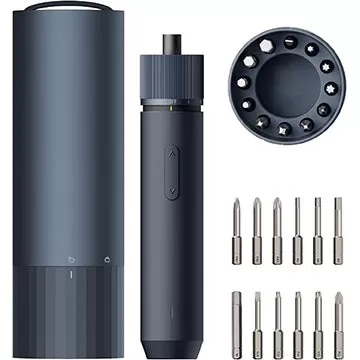
Hoto Tools 3.6V Screwdriver Drops to $27.99
For a limited time, get the Hoto 3.6V Electric Screwdriver on Amazon for just $27.99 by applying coupon code "IEOJN94O" at checkout. This marks the lowest price we've found for this model, saving you $2. Ideal for DIY enthusiasts working with small e
Apps like GPS Map Camera App


Vintage Camera - Dazz
Photography丨33.00M


GOAT – Sneakers & Apparel
Photography丨172.42M


Latest Apps


Wall Paint Calculator
Lifestyle丨10.00M

Logi Circle
Lifestyle丨49.50M

تكبير المؤخرة و الارداف
Lifestyle丨13.00M


Sound monitor FFTWave
Tools丨4.30M

iDate Singles
Communication丨25.20M

Trending Apps
MORE +


Top News
MORE +

01
02-03
Roblox: Anime Adventures Codes (January 2025)
Anime Adventures Codes: A Comprehensive Guide to Free Gems and Rewards
This guide provides an up-to-date list of working and expired Anime Adventures codes in Roblox. Redeeming these codes grants valuable in-game gems and other rewards, giving you a head start in your adventure.
Updated January 5,
02
05-26
Enhance Your MU Immortal Experience with BlueStacks Features
MU Immortal captures the essence of classic MMORPG gameplay that fans adore—leveling up, enhancing stats, and crafting your ideal character. Designed primarily for mobile, the game truly shines when played on a PC using BlueStacks, thanks to an array of tools that streamline and enhance your gaming
03
05-16
"Clair Obscur: Expedition 33 Hits 1 Million Sales in 3 Days"
Clair Obscur: Expedition 33 has taken the gaming world by storm, achieving a phenomenal opening weekend by selling over 1 million copies just three days after its launch. This remarkable feat cements its status as the highest player-rated game of early 2025. Dive deeper into the journey of this grou
04
04-21
Roblox Anime Genesis: January 2025 Codes
Dive into the thrilling world of Anime Genesis, a dynamic tower defense game on Roblox where you assemble a squad of your favorite anime characters to fend off menacing monsters. Whether you're tackling levels solo or teaming up with friends, you'll earn gems that you can use to summon new heroes, e
05
01-20
New DLC and Preorder for FANTASIAN
FANTASIAN Neo Dimension: DLC and Pre-order Information
While anticipation for extra content is high, a FANTASIAN Neo Dimension DLC or story expansion is unlikely. Mistwalker head Hironobu Sakaguchi has stated his preference against sequels, aiming for complete, self-contained gaming experiences.
Topics
More +